
Hiking
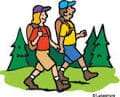 Emerson Hiking Network
From Jim Wallis:
I am putting together a network of people who would like to hike together. These can be hikes ranging from Easy to Moderate to Difficult/Strenuous; ranging in length from a mile to many miles; as close as the surrounding hills & mountains up to a few hours away; weekends or weekdays. OK how are we going to do that? The idea is all over the map (pun intended).
We build a network – Names, email, & phone/text numbers of all who are interested. Anyone in the network can decide they want to take a hike. That person sets the where/what/when and then emails everyone in the network with description, maps, etc. If you want to go you Reply All. You can plan something weeks ahead or at the drop of a hat if you are looking for someone to join you last minute, text the network.
If you want to become part of the Emerson Hiking Network please send your contact info (email & text number) to Jim Wallis (listed in Emerson Directory). Once we have a few members I will distribute contacts to everyone in the network.
♫ Happy Trails to You ♫
We have a State Park right here in our backyard Santa Susana Pass State Historic Park with lots of great relatively short hikes (.5 to about 2.5 miles). You can hike there on your own or you can take one of these:
Community Nature Walks and Hikes:
All walks led by Santa Susana Pass State Historic Park volunteer Hike Leaders trained by the California Department of Parks and Recreation.Supported by the Foundation for the Preservation of the Santa Susana Mountains.www.fpssm.org
El Camino Nuevo/Upper Meadow Loop Hike.
Meet at the Rocky Peak parking lot* on Santa Susanna Pass Road.
Difficulty Level: Moderate; Length: 1.5 miles
El Camino Nuevo/Upper Meadow Loop Hike.
Meet at the Rocky Peak parking lot* on Santa Susanna Pass Rd.
Difficulty Level: Moderate; Length: 1.5 miles
Slow & Gentle Mindfulness Hike.
Meet at the Larwin Trailhead*.
Difficulty Level: Easy-Moderate. Length: 0.75 miles
El Camino Nuevo/Upper Meadow Loop Hike
Meet at the Rocky Peak parking lot on Santa Susanna Pass Road*
Difficulty Level: Moderate; Length: 1.5 miles
Stagecoach Trail Hike.
Meet at the Larwin Trailhead*;
Difficulty Level: Difficult; Length: 2.0 miles
El Camino Nuevo/Upper Meadow Loop Hike*
Meet at the Rocky Peak* parking lot on Santa Susanna Pass Road*
Difficulty Level: Moderate; Length: 1.5 miles
Slow & Gentle Mindfulness Hike
Meet at the Larwin Trailhead*.
Difficulty Level: Easy-Moderate; Length: .75 miles
Welcome Walk
Meet at the Andora Trailhead*.
Difficulty Level: Moderate; Length: 1.5 miles
All hikes:
– Temperatures above 90 degrees, rain or red flag warning cancels.
– Wear long pants because the brush is thick and sticky. A light jacket or long-sleeved shirt is also recommended. Although we try to avoid poison oak, sometimes it is encountered. Wear sturdy hiking boots. A walking stick is preferred by some hikers. Bring plenty of water. A hat is also recommended.
*Locations:
The Andora Trailhead is just south of the Oakwood Cemetery in Chatsworth. 9955 Andora, Chatsworth, CA 91311. Look for the opening in the fence and the brown State Park kiosk. Park on the street. DO NOT follow the online directions to the State Park because it will take you to a different entrance.
The Larwin Trailhead is located on Larwin Street in Chatsworth, 91311. Heading west on Devonshire, Larwin is the last street before Chatsworth Park South entrance. Turn left/south on Larwin, pass the homeowners’ office and lot and you will see the park entrance on your right.
El Camino Nuevo/Upper Meadow Hike: Meet at the Rocky Peak parking lot on Santa Susana Pass Road. The parking lot is SOUTH of the 118 at the Rocky Peak exit. Do NOT park in the lot north of the 118 (you’ll be on the wrong side of the freeway). Look for the hike leader wearing a California State Parks and Recreation Volunteer badge. (Map below shows 118 Freeway from LA to Simi with the south side parking lot and trailhead marked in red.)
